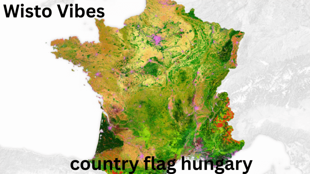
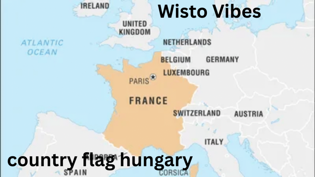
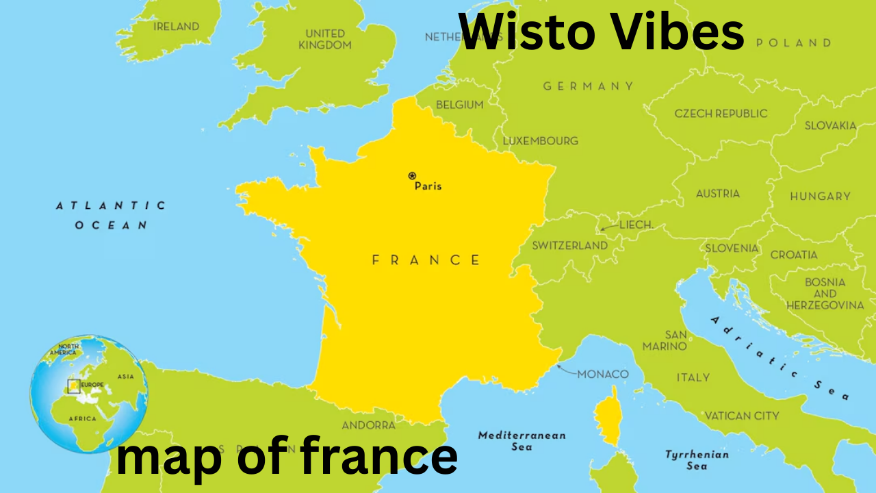
The map of France is not just a simple geographical illustration; it is a symbol of history, culture, and identity. France, located in Western Europe, is the largest country in the European Union and is often referred to as “L’Hexagone” due to its six-sided shape. A look at the map of France reveals much more than borders—it tells stories of historical boundaries, geographical diversity, and cultural richness. From the towering Alps to the scenic Atlantic coastlines, the map of France highlights a nation that has been central to European history for centuries.
Physical Geography on the Map of France

When observing the map of France, the first element that stands out is its vast geographical variety. France covers an area of approximately 643,000 square kilometers, making it the third-largest country in Europe after Russia and Ukraine.
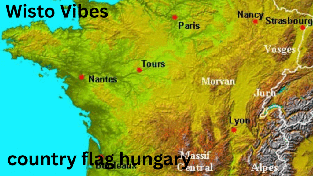
- Mountains and Highlands: The map shows the Pyrenees to the south, forming a natural border with Spain, and the Alps to the east, where Mont Blanc stands as the highest peak in Western Europe. The Massif Central, a region of ancient mountains, is another significant feature visible on the map.
- Rivers and Waterways: Major rivers such as the Seine, Loire, Rhône, and Garonne stretch across the land, shaping agriculture, trade, and settlement patterns. These waterways are key landmarks on any detailed map of France.
- Coastlines: France is bordered by the Mediterranean Sea, the Atlantic Ocean, and the English Channel. This geographical position explains the nation’s long history of maritime trade and cultural exchange.
Political Divisions on the Map of France

The map of France is divided into administrative regions, each with unique identities and functions. Today, France has 13 metropolitan regions and 5 overseas regions.
- Metropolitan France: Regions such as Île-de-France (where Paris is located), Provence-Alpes-Côte d’Azur, Normandy, Brittany, and Nouvelle-Aquitaine are clearly outlined on the map. Each region highlights historical territories that were once independent kingdoms or duchies.
- Overseas Territories: The map of France also extends beyond Europe, including Guadeloupe, Martinique, Réunion, Mayotte, and French Guiana. These areas show France’s historical role as a colonial power.
- Departments and Communes: The administrative structure is further divided into 96 metropolitan departments and thousands of communes, which can also be seen on detailed maps of France.
Historical Evolution of the Map of France

The map of France has undergone significant changes over centuries due to wars, treaties, and political unions.
- Medieval France: The early map was fragmented into feudal territories under lords and kings. The expansion of the Capetian dynasty slowly unified these lands.
- Treaty of Verdun (843): This treaty divided the Carolingian Empire, giving rise to boundaries that eventually shaped modern France.
- Hundred Years’ War and Renaissance: Borders shifted repeatedly as France clashed with England. By the 15th century, France consolidated much of its territory.
- Napoleonic Era: Napoleon’s conquests expanded the French map far beyond its modern boundaries, although these gains were later lost.
- Modern France: After World War I and II, France’s borders stabilized. The map today reflects centuries of conflict, diplomacy, and integration into the European Union.
Major Cities on the Map of France
A closer look at the map of France reveals its major cities, each with historical and cultural importance.
- Paris: The capital and cultural heart, located in the north-central region along the Seine River.
- Lyon: A city at the confluence of the Rhône and Saône rivers, known for its gastronomy and Roman heritage.
- Marseille: France’s largest port, located on the Mediterranean coast.
- Toulouse: An aerospace hub in the southwest, famous for its pink brick architecture.
- Bordeaux: Located along the Garonne, renowned for its world-class wines.
- Lille, Strasbourg, and Nice: Each city brings regional distinctiveness that makes the map of France culturally diverse.
Natural and Cultural Landmarks on the Map of France
The map of France is also dotted with landmarks that combine natural beauty with human achievement.
- Loire Valley: Known as the “Garden of France,” home to historic châteaux.
- Normandy Coast: Famous for its World War II landing beaches.
- French Riviera: A glamorous Mediterranean coastline marked on the southern map of France.
- Provence: Lavender fields and Roman ruins dominate this region.
- Brittany: A rugged coastline with Celtic traditions.
These landmarks show how geography and culture are deeply interconnected in the French map.
The Map of France in Education and Tourism
The map of France is not just for geographers—it is a key tool in education and tourism.
- Education: French schools emphasize geography, ensuring students can identify regions, rivers, and historical boundaries on the map.
- Tourism: Visitors use maps to explore wine routes, hiking trails, and historic towns. The map of France serves as a gateway to exploring cultural richness and natural beauty.
Modern Relevance of the Map of France
In today’s globalized world, the map of France continues to hold importance.
- European Union Role: As a founding member of the EU, France’s map represents both national identity and shared European values.
- Geopolitical Influence: France’s overseas regions extend its reach to the Caribbean, Indian Ocean, and South America, making its map globally relevant.
- Cultural Heritage: The UNESCO heritage sites scattered across the map highlight its universal cultural value.
Conclusion: Why the Map of France Matters
The map of France is more than a geographical outline—it is a reflection of history, culture, and identity. From the snow-capped Alps to the rolling vineyards of Bordeaux, and from medieval fortresses to bustling modern cities, the map illustrates diversity and unity. It tells the story of a nation that has shaped Europe and the world for centuries. Understanding the map of France means appreciating not only its borders but also the narratives of its people, regions, and heritage.
Read More: Romsey City: History, Culture, Lifestyle, and What Makes Romsey City Unique??


